
Category:Electricity pylons in Washington (state)
States of the United States: Alabama · Alaska · Arizona · Arkansas · California · Colorado · Connecticut · Delaware · Florida · Georgia · Idaho · Illinois · Indiana · Iowa · Kentucky · Louisiana · Maine · Maryland · Michigan · Minnesota · Mississippi · Montana · Nebraska · Nevada · New Hampshire · New Jersey · New York · North Carolina · North Dakota · Ohio · Oklahoma · Oregon · Pennsylvania · Rhode Island · South Dakota · Tennessee · Texas · Utah · Virginia · Washington · Wisconsin
Puerto Rico
Puerto Rico
Media in category "Electricity pylons in Washington (state)"
The following 108 files are in this category, out of 108 total.
-
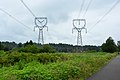
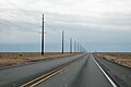 2025-05-22-190618 USA Washington Moses Lake 346.6.jpg 6,192 × 4,128; 9.13 MB
-
 500kV 3-Phase Transmission Lines.png 3,264 × 1,836; 6.31 MB
-
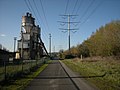
.jpg) Along Iron Horse Trail. I-90 below. (10508311905).jpg 2,048 × 1,536; 991 KB
Along Iron Horse Trail. I-90 below. (10508311905).jpg 2,048 × 1,536; 991 KB
-
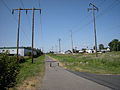 Auburn, Washington - Interurban Trail north from W. Main St.jpg 3,264 × 2,448; 2.16 MB
-
 Auburn, Washington - power lines perpendicular to Green River Road SE - 01.jpg 4,000 × 6,000; 9.28 MB
-
 Auburn, Washington - power lines perpendicular to Green River Road SE - 02.jpg 6,000 × 4,000; 12.05 MB
-
 Auburn, Washington - power lines perpendicular to Green River Road SE - 03.jpg 6,000 × 4,000; 11.59 MB
-
 Auburn, Washington - power lines perpendicular to Green River Road SE - 04.jpg 6,000 × 4,000; 9 MB
-
 Auburn, Washington - power lines perpendicular to Green River Road SE - 05.jpg 6,000 × 4,000; 9.11 MB
-
 Auburn, Washington - power lines perpendicular to Green River Road SE - 06.jpg 6,000 × 4,000; 12.74 MB
-
.jpg) Bare dirt field sometimes called summer fallow (3936747490).jpg 1,632 × 1,224; 1.33 MB
Bare dirt field sometimes called summer fallow (3936747490).jpg 1,632 × 1,224; 1.33 MB
-
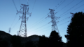
.jpg) Bonneville Power Administration (4436168501).jpg 3,264 × 2,448; 3.36 MB
Bonneville Power Administration (4436168501).jpg 3,264 × 2,448; 3.36 MB
-
.jpg)
-
 Centennial Trail - power lines 01.jpg 4,288 × 2,848; 5.26 MB
-
 Chief Joseph Dam, Washington.jpg 1,730 × 1,354; 396 KB
-
.jpg) Coming 'Round The Mountain (3566134782).jpg 3,906 × 2,602; 2.07 MB
Coming 'Round The Mountain (3566134782).jpg 3,906 × 2,602; 2.07 MB
-
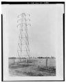
 E4252 - DPLA - f20ee561819f9048472f4027fcb2ed82.jpg 3,715 × 2,830; 5.91 MB
-
 E4269 - DPLA - 72596f9ed62f744194ab8c05bd07924e.jpg 3,719 × 2,879; 6.43 MB
-
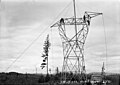 E4274 - DPLA - 5a8c969a3564a7e53bffab6eefd70bbd.jpg 5,231 × 3,699; 8.99 MB
-
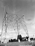 E569 - DPLA - 16a28d4de0f6b59e3335024ba3fe832b.jpg 11,487 × 14,921; 43.18 MB
-
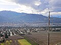 East Wenatchee Washington- NW.jpg 4,592 × 3,448; 6.12 MB
-
 Electricity pylon in Kent, Washington - 1.jpg 3,024 × 4,032; 2.43 MB
-
 Electricity pylon in Kent, Washington - 2.jpg 4,032 × 3,024; 3.35 MB
-
 Electricity pylon in Kent, Washington - 3.jpg 3,024 × 4,032; 3.22 MB
-
 Electricity pylon in Seattle West Ewing Mini Park 01.jpg 4,000 × 6,000; 11.78 MB
-
 Elmer Severin in pumpkin patch, 1960.jpg 1,431 × 1,806; 1.07 MB
-
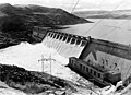 Grand Coulee Dam no forebay.jpg 4,269 × 3,079; 2.83 MB
-
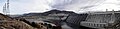 Grand Coulee Dam Panorama - Flickr - brewbooks.jpg 4,688 × 1,136; 2.8 MB
-
 Hay-wagon and railway near Snohomish, WA.jpg 4,288 × 2,848; 5.75 MB
-
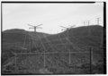
 High Voltage Lines in Washington State.tif 1,920 × 2,560; 28.16 MB
-
 High voltage transmission tower and lines. Auburn WA.jpg 1,572 × 1,204; 451 KB
-
.jpg) Interurban Trail (10488065646).jpg 1,536 × 2,048; 1.41 MB
Interurban Trail (10488065646).jpg 1,536 × 2,048; 1.41 MB
-
.jpg) Interurban Trail south of Seattle (10899475096).jpg 1,536 × 1,024; 444 KB
Interurban Trail south of Seattle (10899475096).jpg 1,536 × 1,024; 444 KB
-
.jpg) Interurban Trail south of Seattle (10899576104).jpg 1,536 × 1,024; 440 KB
Interurban Trail south of Seattle (10899576104).jpg 1,536 × 1,024; 440 KB
-
.jpg) Interurban Trail south of Seattle (10899732403).jpg 1,536 × 1,024; 514 KB
Interurban Trail south of Seattle (10899732403).jpg 1,536 × 1,024; 514 KB
-
.jpg) Interurban Trail south of Seattle, 2010 (33281092253).jpg 3,648 × 2,736; 2.61 MB
Interurban Trail south of Seattle, 2010 (33281092253).jpg 3,648 × 2,736; 2.61 MB
-
 Interurban-Trail-Sign-WA.jpg 1,600 × 1,200; 472 KB
-
.jpg) Intururban Trail near Auburn (10488066906).jpg 2,048 × 1,536; 920 KB
Intururban Trail near Auburn (10488066906).jpg 2,048 × 1,536; 920 KB
-
.jpg) Klickitat Valley Windmills - U.S. Route 97 (24548603724).jpg 5,759 × 3,813; 18.1 MB
Klickitat Valley Windmills - U.S. Route 97 (24548603724).jpg 5,759 × 3,813; 18.1 MB
-
.jpg) Looking north on the Chief Sealth Trail toward VA Hospital (cropped).jpg 530 × 882; 261 KB
Looking north on the Chief Sealth Trail toward VA Hospital (cropped).jpg 530 × 882; 261 KB
-
 Looking north on the Chief Sealth Trail toward VA Hospital.jpg 4,000 × 6,000; 8.75 MB
-
 Looking south on Chief Sealth Trail near S. Brandon St. 01.jpg 4,000 × 6,000; 8.33 MB
-
 Looking south on Chief Sealth Trail near S. Brandon St. 02.jpg 6,000 × 4,000; 9.32 MB
-
 Looking south on Chief Sealth Trail near S. Brandon St. 03.jpg 4,000 × 6,000; 10.08 MB
-
 Looking south on Chief Sealth Trail near S. Brandon St. 04.jpg 6,000 × 4,000; 12.23 MB
-
.jpg) Looking through power line near Steven's Pass (1770334310).jpg 874 × 627; 96 KB
Looking through power line near Steven's Pass (1770334310).jpg 874 × 627; 96 KB
-
 Looking up at electricity pylon, Seattle - West Ewing Mini Park.jpg 6,000 × 4,000; 9 MB
-
 Machias, WA - power lines seen from Centennial Trail 01.jpg 6,000 × 4,000; 11.1 MB
-
.jpg) McNary Dam (10488717786).jpg 2,048 × 1,536; 927 KB
McNary Dam (10488717786).jpg 2,048 × 1,536; 927 KB
-
 New overhead transmission line construction - Flickr - brewbooks.jpg 4,288 × 2,416; 3.92 MB
-
.jpg) Newhalem (1649973716).jpg 941 × 534; 55 KB
Newhalem (1649973716).jpg 941 × 534; 55 KB
-
.jpg) Newhalem, WA. 1993 (9149273790).jpg 1,081 × 734; 95 KB
Newhalem, WA. 1993 (9149273790).jpg 1,081 × 734; 95 KB
-
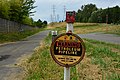 Petroleum pipeline sign along Chief Sealth Trail.jpg 6,000 × 4,000; 13.05 MB
-
-
-
-
-
 Pinus ponderosa 8034.JPG 2,848 × 4,272; 7.18 MB
-
.jpg) Power Grid - Flickr - brewbooks (1).jpg 4,215 × 2,347; 3.68 MB
Power Grid - Flickr - brewbooks (1).jpg 4,215 × 2,347; 3.68 MB
-
 Power Grid - Flickr - brewbooks.jpg 2,094 × 3,816; 3.32 MB
-
.jpg) Power line marching off north of McNary Dam (3571051463).jpg 764 × 651; 293 KB
Power line marching off north of McNary Dam (3571051463).jpg 764 × 651; 293 KB
-
.jpg) Power line near Sedro Wooley, WA. (36441413433).jpg 2,048 × 1,536; 1.15 MB
Power line near Sedro Wooley, WA. (36441413433).jpg 2,048 × 1,536; 1.15 MB
-
.jpg) Power lines at Newhalem, WA. (4937411198).jpg 1,024 × 768; 268 KB
Power lines at Newhalem, WA. (4937411198).jpg 1,024 × 768; 268 KB
-
.jpg) Power lines near Grand Coulee Dam (36245550293).jpg 2,048 × 1,536; 631 KB
Power lines near Grand Coulee Dam (36245550293).jpg 2,048 × 1,536; 631 KB
-
.jpg) Power lines near road to Wilbur from Grand Coulee Dam (37053112515).jpg 2,048 × 1,536; 854 KB
Power lines near road to Wilbur from Grand Coulee Dam (37053112515).jpg 2,048 × 1,536; 854 KB
-
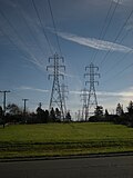
 Power lines near Snoqualmie Falls 01.jpg 4,288 × 2,848; 6.67 MB
-
.jpg) Powerlines Along Ediz Hook (30799942190).jpg 1,200 × 800; 365 KB
Powerlines Along Ediz Hook (30799942190).jpg 1,200 × 800; 365 KB
-
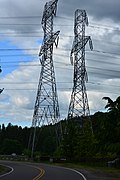
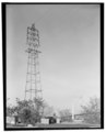
 Pylon at Hannegan Road near Bellingham, Washington US 2017 A.jpg 2,308 × 1,731; 1.51 MB
-
 Pylon at Hannegan Road near Bellingham, Washington US 2017 B.jpg 2,304 × 1,728; 1.66 MB
-
 Pylons for Seattle City Light power lines across the Skagit River at Corkindale.jpg 4,000 × 6,000; 10.75 MB
-
 Quincy Lake 2025.JPG 4,272 × 2,848; 5.33 MB
-
 Rocky Reach Dam Powerlines on the Columbia River.jpg 4,431 × 2,016; 930 KB
-
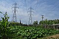
 Seattle - 13th & Snoqualmie P-Patch 01.jpg 4,288 × 2,848; 6.24 MB
-
 Seattle - 13th & Snoqualmie P-Patch 02.jpg 4,288 × 2,848; 6.24 MB
-
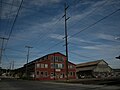 Seattle - NEMCO warehouse 01.jpg 3,264 × 2,448; 1.85 MB
-
 Seattle - power lines near Ferdinand P-Patch.jpg 2,448 × 3,264; 1.93 MB
-
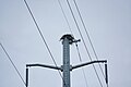 Skagit River - Eagle's nest on power pylon.jpg 6,000 × 4,000; 6.54 MB
-
 Skagit River southwest of Corkindale 04.jpg 6,000 × 4,000; 9.24 MB
-
.jpg) Slater Road entrance to Noocksac Dike Trail (32616252903).jpg 4,608 × 3,456; 5.06 MB
Slater Road entrance to Noocksac Dike Trail (32616252903).jpg 4,608 × 3,456; 5.06 MB
-
.jpg) Sound Transit SODO Station (cropped).jpg 2,091 × 1,526; 1.09 MB
Sound Transit SODO Station (cropped).jpg 2,091 × 1,526; 1.09 MB
-
 Sound Transit SODO Station.jpg 3,264 × 2,448; 3.41 MB
-
 Three Phase Electric Power Transmission.jpg 2,048 × 1,360; 1.46 MB
-
.jpg)
-
-
 Tukwila - old cement plant on W. Valley Rd 01.jpg 3,264 × 2,448; 2.17 MB
-
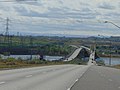 Umatilla Bridges, Apr 17.jpg 2,592 × 1,944; 2.41 MB
-
-
-

-
-
-
-
-
-
-
-
-
-
-
-
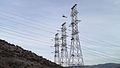
 Washington State Desert Pylons3.jpg 1,648 × 1,072; 284 KB
-
 Washington State Desert Pylons4.jpg 1,644 × 1,060; 1,015 KB
-
 Wind farm 7967.JPG 4,272 × 2,848; 4.24 MB
-
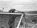
.jpg) Workers installing tower at Boundary Dam, 1967 (36871642215).jpg 1,200 × 952; 371 KB
Workers installing tower at Boundary Dam, 1967 (36871642215).jpg 1,200 × 952; 371 KB
-
.jpg) Yicol 10b (20612264951).jpg 1,589 × 2,636; 1.08 MB
Yicol 10b (20612264951).jpg 1,589 × 2,636; 1.08 MB
-
.jpg) Yicol 11b (19984791523).jpg 3,155 × 1,373; 1.05 MB
Yicol 11b (19984791523).jpg 3,155 × 1,373; 1.05 MB
-
.jpg) Yicol 12b (20605667345).jpg 2,405 × 2,600; 1.82 MB
Yicol 12b (20605667345).jpg 2,405 × 2,600; 1.82 MB
-
.jpg) Yigco 5b (7686369304).jpg 1,213 × 1,547; 357 KB
Yigco 5b (7686369304).jpg 1,213 × 1,547; 357 KB